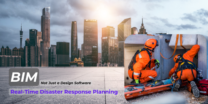
How BIM Supports Real-Time Disaster Response Planning
Introduction
Disasters, whether natural or man-made, can disrupt lives and damage communities. Preparing for such events is critical, especially in urban areas where risks are higher. Disaster response planning plays a key role in saving lives and reducing damage.
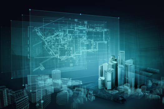
Building Information Modeling (BIM) is changing how we approach these challenges. BIM provides detailed digital models of buildings and infrastructure. These models contain real-time data and valuable insights that can guide decision-making during emergencies.
With BIM, emergency teams can understand building layouts, assess risks, and plan responses more effectively. It also helps with evacuation planning and identifying potential hazards. By integrating technology and data, BIM enhances preparedness and supports faster recovery.
This article delves into how BIM supports real-time disaster response planning. We will explore its role in ensuring safety, improving coordination, and building resilience during critical situations.
Understanding BIM in Disaster Response
Building Information Modeling (BIM) is a powerful tool that creates detailed digital representations of buildings and infrastructure. These models showcase both the physical and functional characteristics of a structure, making them invaluable for various applications. In disaster response, BIM becomes an essential resource for emergency teams.
BIM’s 3D models provide detailed visuals of a building’s structure. They include vital information such as material types, dimensions, and spatial relationships between different areas. For responders, this means instant access to layouts, which helps them plan actions more effectively during critical moments.
When disasters strike, time is of the essence. Emergency teams often work in high-risk situations where accurate information can save lives. BIM gives them a clear understanding of building vulnerabilities, evacuation routes, and potential hazards like weak walls or hazardous materials.
Beyond immediate response, BIM also helps assess damage after disasters. Teams can compare pre-disaster models with real-time data to identify structural changes and prioritize repairs. By offering a shared, centralized resource for all stakeholders, BIM ensures everyone has the information they need to make informed decisions quickly and effectively.
BIM isn’t just a tool for design; it’s a lifesaver in disaster response planning and execution.
Real-Time Data Integration
Real-time data is a game-changer in disaster response. When paired with Building Information Modeling (BIM), it creates a powerful system for managing emergencies. By integrating real-time information, BIM models can provide up-to-the-minute updates on a building’s condition during a crisis.
Sensors and Internet of Things (IoT) devices are key players in this process. These devices continuously monitor factors like structural integrity, temperature changes, and air quality. They can even detect fire progression or the presence of hazardous materials. This live data feeds directly into BIM platforms, giving responders a clear, accurate picture of what’s happening on the ground.

This dynamic approach enables teams to adjust their strategies quickly. For example, if a sensor detects that a structure is becoming unstable, evacuation routes can be updated instantly to keep responders and occupants safe. Similarly, knowing the exact location of hazardous materials helps prevent additional risks during cleanup.
Real-time data integration also enhances communication among stakeholders. Everyone involved, from emergency teams to facility managers, operates with the same live information. This improves coordination and reduces delays.
By combining real-time insights with BIM’s detailed models, emergency operations become faster, safer, and more effective when every second counts.
Enhancing Emergency Preparedness
Preparing for disasters is the first step to saving lives and minimizing damage. Building Information Modeling (BIM) plays a vital role in this process. Its detailed digital models help planners develop evacuation plans and simulate disaster scenarios to improve readiness.

By analyzing BIM models, emergency planners can study the layout of a building or area in detail. This allows them to identify the best evacuation routes and locate potential problem areas, such as narrow hallways or blocked exits. With this information, they can design safer and more efficient escape plans for various emergencies.
Simulations are another powerful feature of BIM. Using these models, teams can test different disaster scenarios, from fires to floods or earthquakes. These virtual drills help refine response strategies, ensuring they are effective under real-world conditions. They also allow personnel to practice and prepare, building confidence and coordination before a crisis occurs.
BIM’s ability to combine real data with predictive tools makes it an essential part of modern emergency preparedness. It ensures that response plans are not only well-designed but also tested and ready to deploy when needed. With BIM, communities and organizations can better face the unexpected and protect lives.
Facilitating Coordination Among Stakeholders
Disaster response depends on teamwork. Emergency responders, facility managers, and government agencies must work together under intense pressure. Building Information Modeling (BIM) simplifies this process by acting as a centralized hub for information.

BIM provides a single platform where all stakeholders can access the same up-to-date data. Whether it’s building layouts, hazard locations, or evacuation plans, everyone involved has the information they need to make quick, informed decisions. This shared understanding reduces confusion and ensures every action is aligned.
For example, during a fire, responders can use BIM models to locate fire exits or assess structural weaknesses. At the same time, facility managers can guide efforts remotely using real-time data from sensors. Government agencies can coordinate resources based on this accurate information.
By improving communication and coordination, BIM helps teams respond faster and more effectively. In emergencies, this collaboration can save lives and reduce damage.
Case Studies and Applications
BIM has proven its value in real-world disaster response scenarios. In fire emergencies, for instance, BIM models have helped plan evacuation routes and guide rescue operations. By providing detailed layouts and identifying fire exit locations, responders can act faster and more safely.
In earthquake-prone areas, BIM has been instrumental in assessing building vulnerabilities. Structural details from BIM models allow engineers to evaluate risks and prioritize retrofitting measures to strengthen buildings. This proactive use of BIM reduces the likelihood of severe damage during seismic events.
BIM has also been applied in flood response. Digital models have been used to simulate water flow and predict which areas might be most affected. This insight supports better resource allocation and mitigation planning.
These examples highlight BIM’s versatility in disaster scenarios. Whether it’s improving evacuation strategies or aiding long-term planning, BIM equips teams with the tools to enhance disaster resilience and recovery.
Challenges and Considerations
While BIM offers significant advantages in disaster response, implementing it comes with challenges. High-quality data is essential for BIM to be effective, yet collecting and maintaining accurate information can be time-consuming and costly. Without reliable data, the benefits of BIM may be limited.

Another hurdle is interoperability. Different stakeholders often use varied systems and formats, which can create compatibility issues. Ensuring that BIM integrates seamlessly with these systems requires standardized protocols and advanced technology.
Data security is also a critical concern. BIM models store sensitive information about buildings and infrastructure. Protecting this data from unauthorized access is essential to prevent misuse or breaches, particularly during crises.
Overcoming these challenges demands investment in technology, training, and collaboration. Developing clear standards and providing training to emergency teams can make BIM more accessible and effective. With the right approach, these barriers can be addressed, unlocking BIM’s full potential for disaster response.
Conclusion
BIM is transforming disaster response planning with its ability to integrate real-time data, improve preparedness, and foster better coordination among stakeholders. Its detailed models and simulations enable teams to make informed decisions, act quickly, and minimize risks during emergencies. By addressing challenges such as data quality and security, BIM can be further optimized to support even more effective responses. Communities that leverage BIM are better equipped to face disasters, protecting lives and infrastructure. As the need for robust disaster management grows, BIM remains a pivotal tool in building resilience and ensuring faster, safer recoveries.